Windham New Hampshire Geography
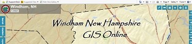
This page provides access to Geographic Information System (GIS) data for the Town of Windham including aerial photography, property parcel cards and related data, zoning districts, and other mapped information.
This site allows users to search parcels by property owner, address, or parcel, and to perform tasks including measurements, map creation and identifying abutters.
Click here to enter the GIS system
Town Map Links:
Current Tax Maps
|
Overlay District Maps |
| Current Zoning and Street | Watershed Maps |
| Land Management Maps | Trail Maps |
| Miscellaneous Maps |
New Hampshire's Statewide Geographic Information System Clearinghouse
- NH Granit
- New Hampshire Hydrography
- (NHHD) Dataset (Granit Data)
Of Interest
- Southern New Hampshire Planning Commission
- NH Office of Energy and Planning
- UNH Geography Department